It is designed for visual authoring of GPS-maps in various cartographic formats.
Add geotagging information to your photos.
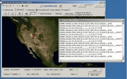
The simulator provides a complete suite for all your GPS simulating needs.
Terrain Tools provides a set of tools that allows you to create maps.
TerraExplorer Plus provides advanced tools for measurement and terrain analysis.